Posts Tagged ‘Phacelia’
2026 Botanizing Season Begins
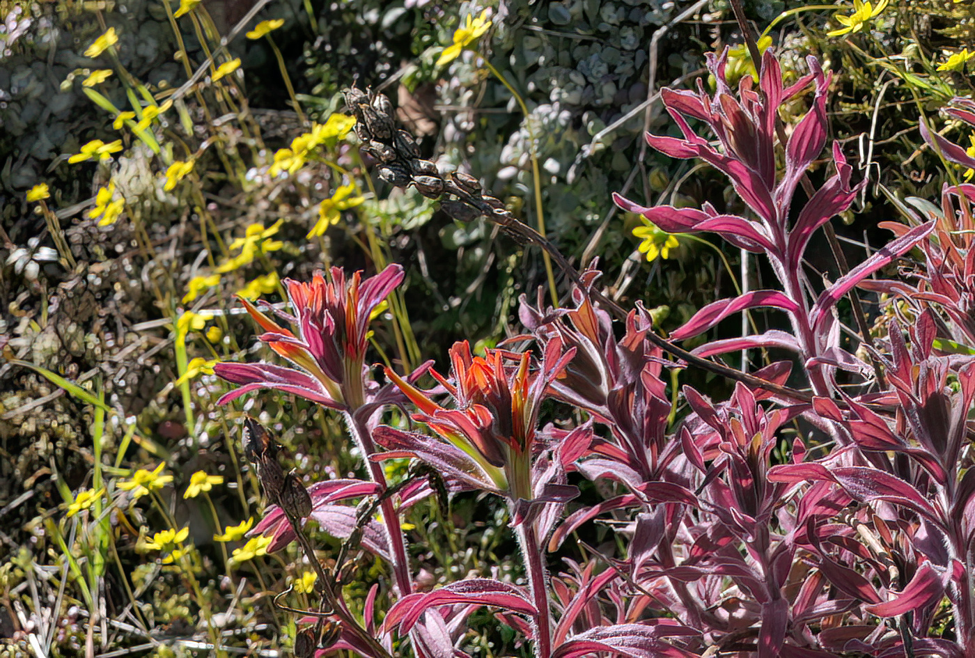
A single harsh paintbrush (Castilleja hispida) plant was coming into bloom along the reservoir cliffs, with gold stars blooming nearby.
The forecast for March 7th was partly sunny and above 60°. While I’d seen one butterfly and some early flowers at home, I was anxious to get out to see many more, so I decided to put my work aside and head out Road 21 along Hills Creek Reservoir and through the Rigdon area for my annual season-opening trip. My usual early flower friends were all out, gold stars (Crocidium multicaule) being the standout, as usual. The Sierra gooseberry (Ribes roezlii) was just beginning to flower, and the Hall’s lomatium (Lomatium hallii) was also getting started. The clouds were breaking up, and I passed several California tortoiseshells as I drove along the reservoir, so it was really starting to seem like spring.
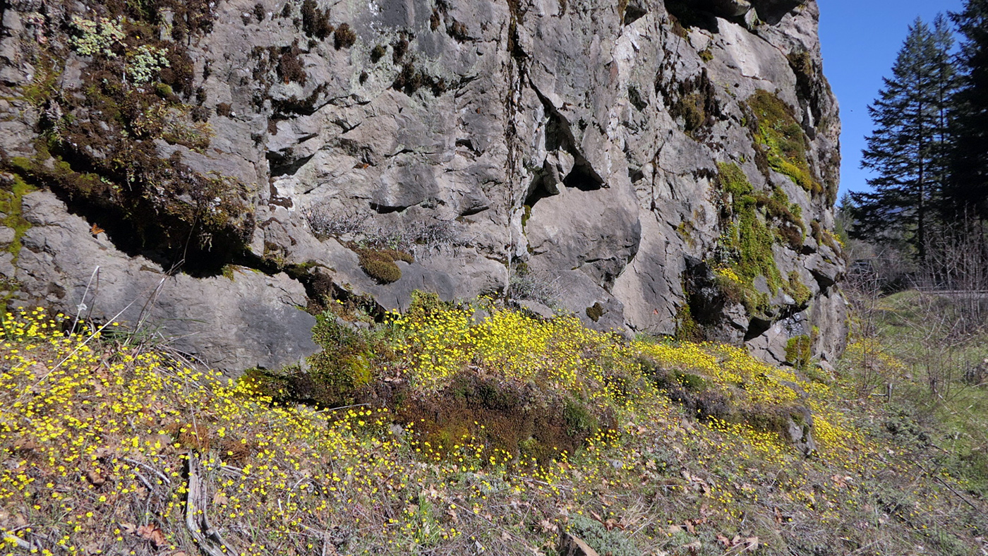
The gold stars were beautiful at the base and on top of “Ladybug Rock,” just 6/10 of a mile before Camper’s Flat campground. This is the biggest gathering place of California tortoiseshells on warm sunny days in March.
After my usual stops along the cliffs at the reservoir between mileposts 7 and 10, I stopped for lunch at Everage Flat. Last year, Kate Shapiro joined me for my first trip of 2025 (which I apparently never blogged about). While at Everage Flat, we spent quite a while removing Scotch broom (Cytisus scoparius), which was threatening to take over the wooded area at the north end. This is where there is a good-sized population of long-spurred piperia (Platanthera elongata). I was relieved to find less than a dozen Scotch broom still there, and I quickly dispatched those. The Forest Service is so understaffed and underfunded—especially for botany work—that volunteer effort is going to be needed to keep weeds under control. The skunk cabbage (Lysichiton americanus) wasn’t even up yet, but I checked on the single plant of straggly gooseberry (Ribes divaricatum), and was happy to see a healthy branch, though with no flowers yet. The large Scouler’s willow (Salix scouleriana) was in full bloom by the road with lots of fly activity, but the few California tortoiseshells showed no interest in it.
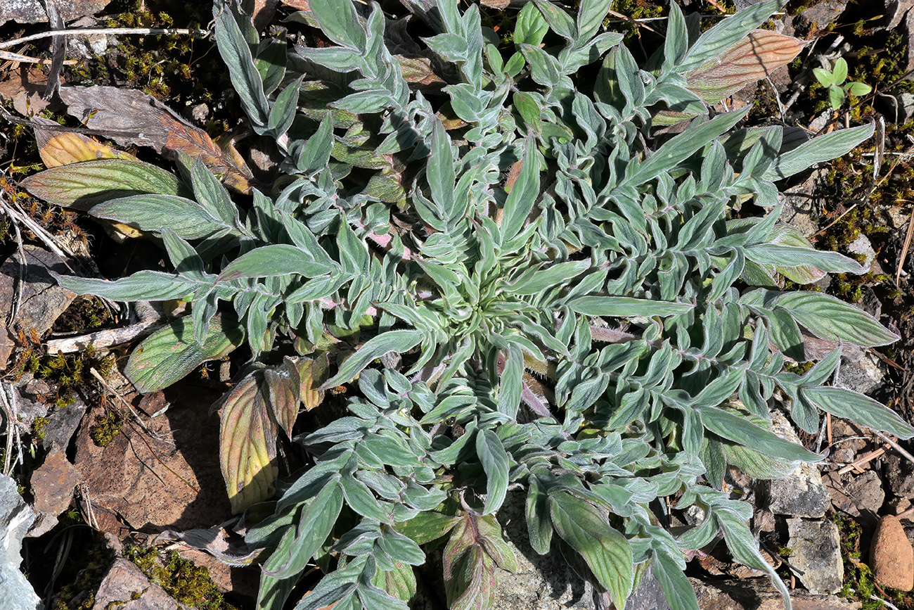
The second year rosettes of varileaf phacelia (Phacelia heterophylla ssp. virgata) are quite beautiful before they send up the flowering stalk. These grow profusely along Road 21 at the north end of the reservoir as well as in one spot along the west side.
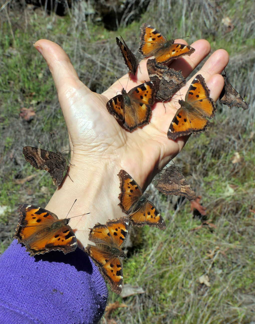
This was a new record for me—11 California tortoiseshells at once. There were also several alighting on my pants and my camera bag. Once one lands, everyone else wants to see what the fuss is about.
The highlight of the day had to be checking out the tortoiseshell gathering on “Ladybug Rock”. They rarely disappoint me on my first trip out. There were probably about 50 fluttering around on the sunny rock face. Only one little echo azure was also out, nectaring on gold stars. A little bit farther up the road, there’s a small creek that runs over the road bank. For some reason, that’s where I get the most attention from the butterflies. I spent almost half an hour “collecting” butterflies on my sweaty hand. I beat my previous record of 9 butterflies on one hand that I set in 2022 (see 2022 Botanizing and Butterflying Season has Begun!). I could try for two hands next year—but then I wouldn’t being able to photograph them!
My next stop was Camper’s Flat to check out the blooming white alders (Alnus rhombifolia) along the Middle Fork of the Willamette River. I also climbed up to the opening on the other side of the road to see the tiny-flowered meadow nemophila (Nemophila peduculata) and was very happy to see the first flowers of chickweed monkeyflower (Erythranthe alsinoides). I’ve spent the last few months working on a treatment for Phrymaceae for the Flora of Oregon, Volume 3. I’ve looked at lots of specimens of monkeyflowers online and in the OSU Herbarium as well as my photos and those on iNaturalist and elsewhere, but I was really looking forward to seeing living plants again. Their flowers are so delicate, they just don’t press well, and many of the important features can’t be seen well in photos either. It’s also really hard to see the vestiture—the hairs that cover the herbage and are often present in the flowers. There’s just no substitute for seeing the plants in the wild.
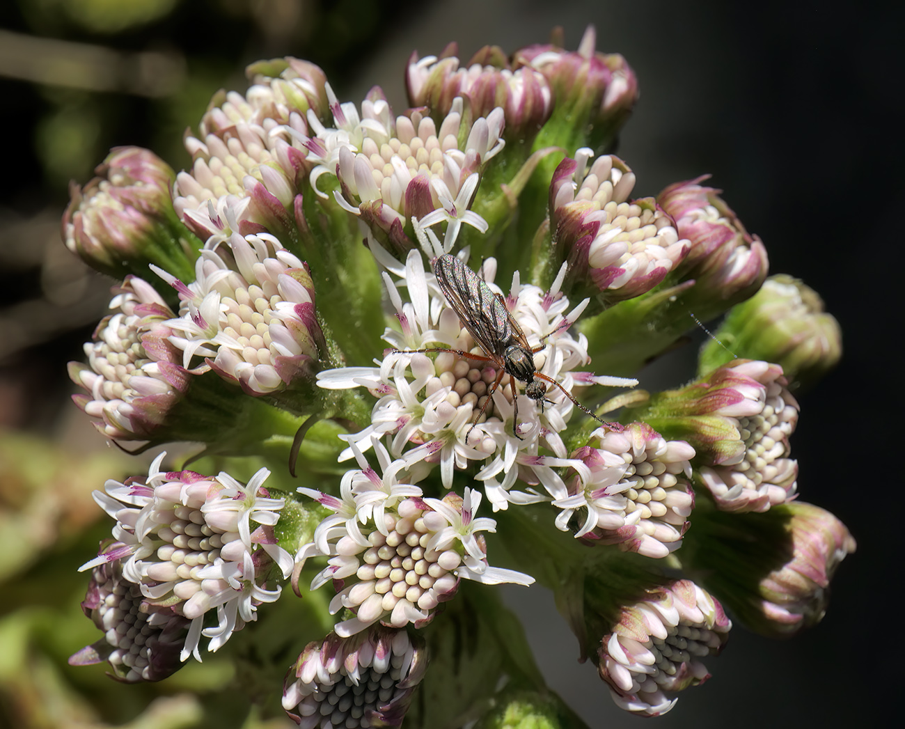
Most of the pollinators I saw were flies, like this one on a fresh sweet coltsfoot (Petasites frigidus).
That was all pleasant botanizing and butterfly watching, but now it was time for the task I wasn’t exactly looking forward to. Last August, the Emigrant Fire was started by lightning and burned across an area over 33,000 acres south of Road 21, east of Staley Creek Road 2134, and much of the way up to the Calapooya Crest. I hadn’t been in the area since and was afraid of what I might find. Someone recently told me that the forest around Grassy Glade was devastated. I wasn’t sure if I could stand to see it yet, so I decided to head to Sacandaga Campground first, as it is right next to the northern end of the fire, and I hoped it would have been protected. There was no sign of burned trees all the way to the campground—yay! Rigdon Meadow was surrounded by green trees. I could see a desolate ridge to the east and was puzzled. Wasn’t that already burned in the Tumblebug Fire back in 2009? But then why is it still completely dead 16 years later? I had forgotten that most of the Emigrant Fire was actually in the footprint of the previous fire—the heavy fuel load of dead wood and brushy regrowth had fueled the explosive spread of the fire.
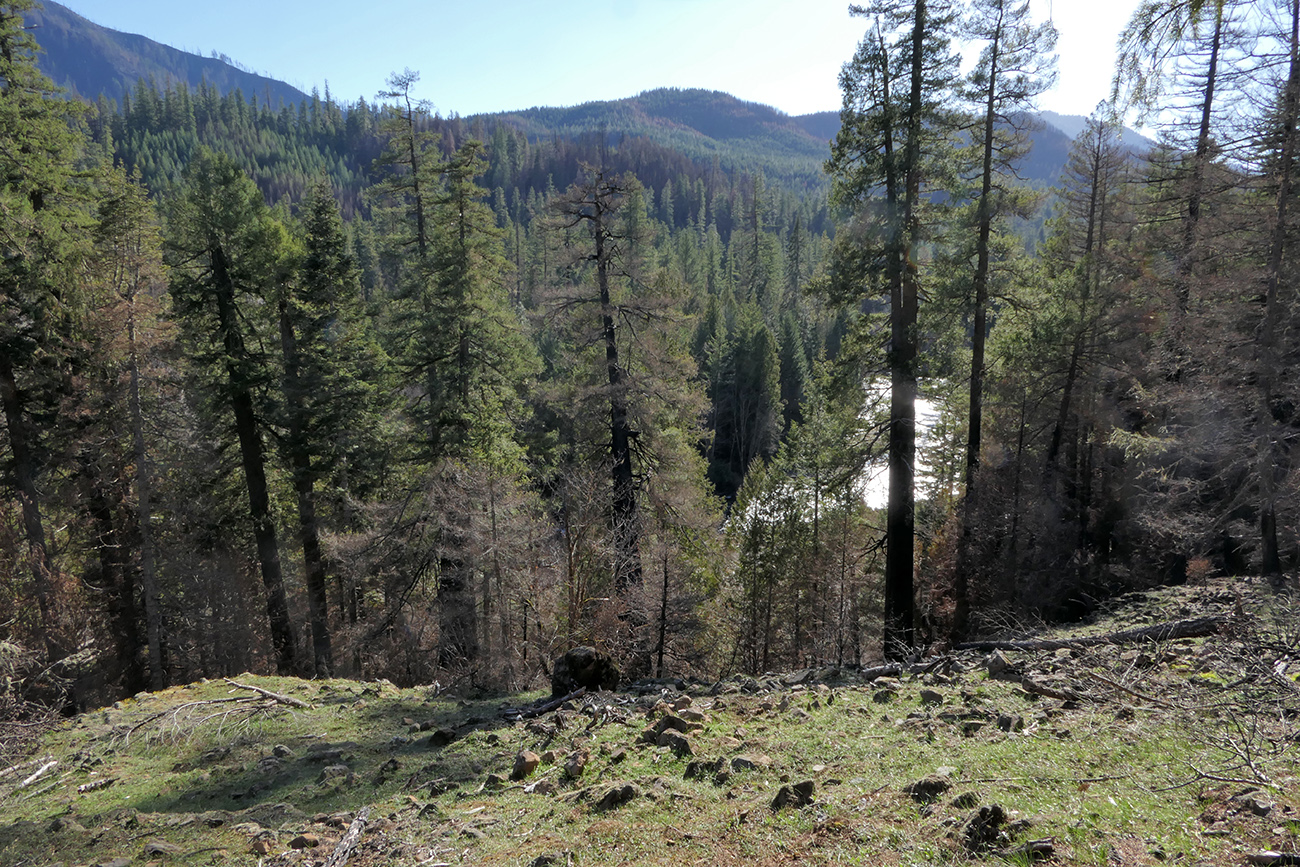
The view southwest across the Middle Fork of the Willamette River reveals only patchy burned forest at the north end of last year’s Emigrant Fire.
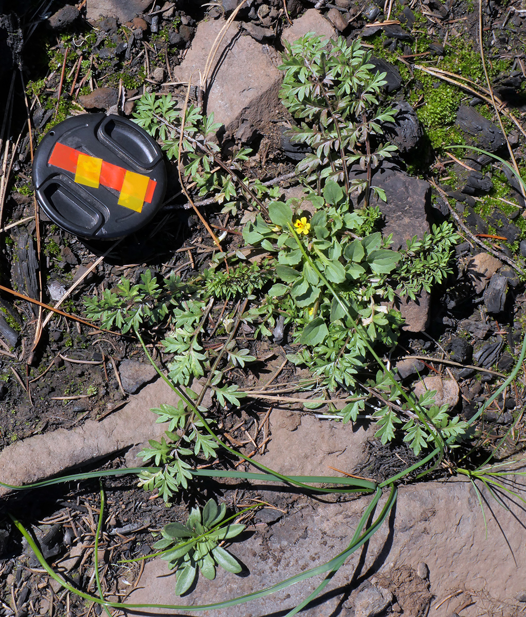
While most of the Sacandaga Campground was unscathed, Sacandaga Bluff was burned. The annuals and bulbs seemed to benefit from it. This seedling bluefield gilia (Gilia capitata) was probably three times bigger than any I have growing at home. There were lots of chickweed monkeyflowers as well.
When I climbed up the south end of the campground to “Sacandaga Bluff,” I was dismayed to finally see signs of fire. I had hoped to see all the early pollinators that enjoy the large manzanitas up there, but the manzanitas appeared to have been cut and strewn about. The fallen logs were burned black, and the standing trees were alive but charred at the base. Looking south across the river, most of the forest was green with only patchy brown areas, so it seems unlikely the fire crossed the river. I guessed the firefighters must have lit a backburn to protect the campground. A call to the Middle Fork Forest Service office this morning confirmed this. I looked around for signs of the rare Sierra cliff brake (Pellaea brachyptera) but couldn’t locate it. I hope that the fire was light enough to take out last year’s dead fronds without killing the plants, but I won’t know for a while. There was also no sign of the many-stemmed sedge (Carex multicaulis), also at the northern end of its range. On the other hand, the annuals and bulbs seemed to be coming up profusely, likely a little extra carbon stimulating their growth.
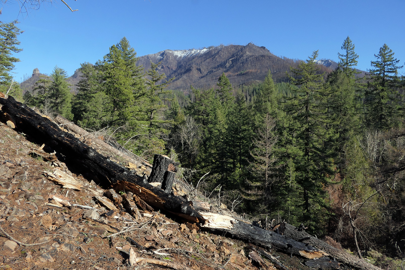
From Sacandaga Bluff, you can see the Tumblebug Fire scar now reburned. It doesn’t look that different than it did 5 years ago (see On the Menu at the Butterfly Café) except the pocket of green that escaped the 2009 fire is mostly gone now. Note also how much less snow is on the ridge than in 2021 at the end of March.
Relieved that the fire damage there was not as bad as I thought, I headed up Staley Creek Road to take a look at the Staley Creek Gorge. No signs warning of closures or dead trees—that’s promising. No sign of burned trees. I started getting hopeful the area was spared. I was able to let some of my trepidation go as I arrived at the bridge across Staley Creek. There was a small burned area to the left of the far side of the bridge, but it was the least interesting area botanically. Whew! I didn’t have time to head all the way up to Grassy Glade (and I’ve now found out that the road is actually closed, though there were no signs), but I did drive up Road 2137 a tenth of a mile to inspect the small roadcut openings that are so floriferous in the spring. Much of the meadow area was fine with lots of gold stars in bloom and other species just emerging, but there was no sign of the perennial Howell’s pussytoes (Antennaria howellii), and the woods above were largely burned. This is the lowest elevation that I’ve seen this uncommon species. Perhaps it will come back from seed. All in all, I’m relieved that the area is not as damaged as I’d been imagining all winter. Hopefully, this summer won’t be too bad, but I’m bracing myself for more fires in the future.
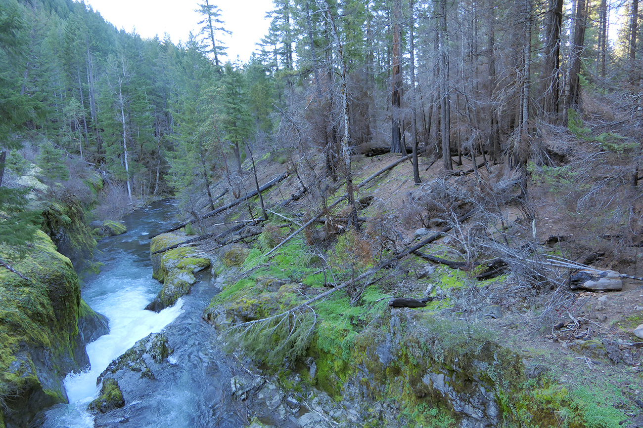
Only a small area on the northeast side of the Staley Creek Bridge was burned. I had worried that the lovely Pacific yews (Taxus brevifolia) in the primitive camping area on the south side of the bridge were gone, but thankfully they were untouched.

This little meadow above the roadcut on Road 2137 did get burned. The largest dead tree in the middle of the photo was an impressive sugar pine. I’m very sad to lose that one.
Beetles and Botany at Bearbones
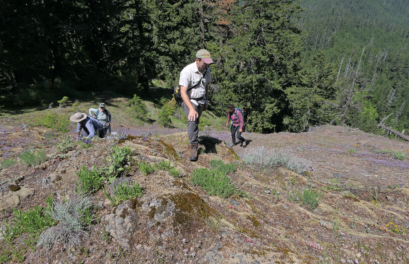
Angela, Leela, Sol, and Lauren exploring the north side of Bearbones Mountain a little below the summit. We were surprised to see rubber rabbitbrush (Ericameria nauseosa) growing in the cooler conditions of the north-facing slope. More common to the south and east, it usually grows in hotter, drier sites. The purple tinge on the slope was a large sweep of large-flowered blue-eyed Mary (Collinsia grandiflora).

Stunning cliff penstemon lights up the rocky ridge. The two rocky slopes in the nearest ridge are Spring Butte. The small prominence behind and to the left is “Mosaic Rock” where I went in May (see Long-awaited Return to Mosaic Rock). The large ridge beyond that is Staley Ridge.
Bearbones Mountain is a former lookout site with a 360° view, and it is a really interesting area botanically, but the trail is little known, rarely used, and hard to find now that the hiker symbol post is gone. I’ve been trying to bring people up there for years to see its hidden treasures. On June 9th, I introduced it to four more botanically minded folks, two of whom work for the Middle Fork district of the Willamette National Forest where it is located but hadn’t been there yet. The flowers were even better than when I’d been there a couple of weeks before (see First Trip of the Year to Bearbones Mountain). The cliff penstemon (Penstemon rupicola) was outstanding, and there were plenty of other beautiful wildflowers to keep everyone satisfied. We also saw interesting insects although I was again disappointed in the relative lack of butterflies. Everyone enjoyed the beautiful weather and great view. It’s a good place to get oriented when you’re in the southeastern part of Lane County. Hopefully my younger friends will bring other flower lovers up here in the future. Read the rest of this entry »
First Trip of the Year to Bearbones Mountain
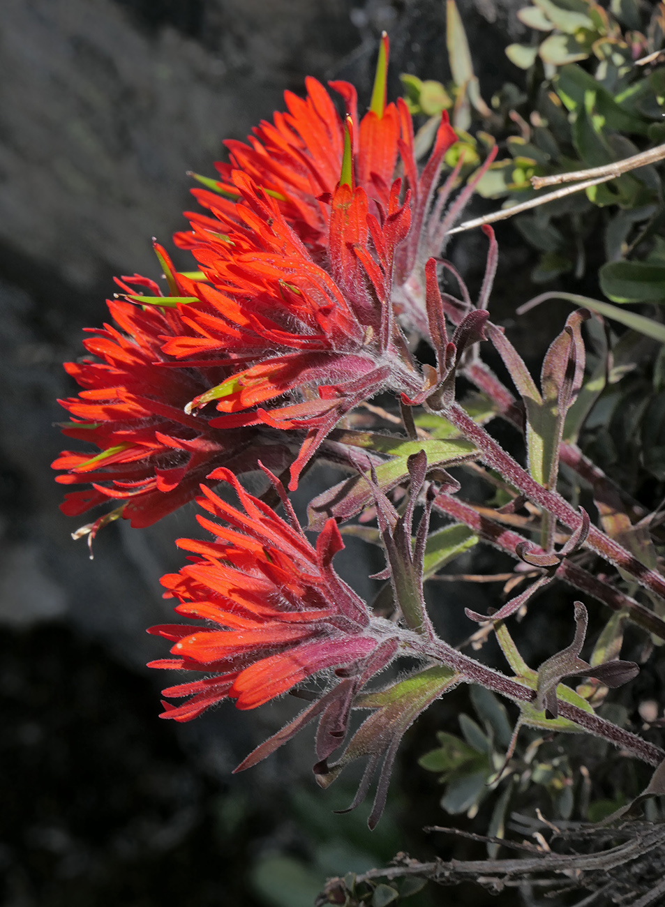
I was able to get close to some beautiful cliff paintbrush (Castilleja rupicola) on my way up the north side of the summit. Most of the other plants I saw were out of reach.
I recently heard from Chad Sageser that he had cleared the roads (2127 and 5850) to Bearbones Mountain of fallen trees. What a hero! With all the interesting early plants on this old lookout site, I decided to head up there as soon as possible. On May 31, I drove up there by myself. I’d missed the earliest flowers—only a couple of glacier lilies (Erythronium grandiflorum) were still blooming—but the rest of the flowers were beautiful, and there was more spring phacelia (Phacelia verna) than I’d ever seen before. I was a bit tired, so I didn’t make it as far down the side ridge as I usually go. I also wanted to save a little energy for a quick but steep trip up to the top of Big Pine Opening (the big open slope along Road 21 at the intersection of Rd 2135) at the end of the day. This is the lowest site of purple milkweed (Asclepias cordifolia) we know of in the Middle Fork district, so I wanted to see how far along the bloom was. Here are some highlights.
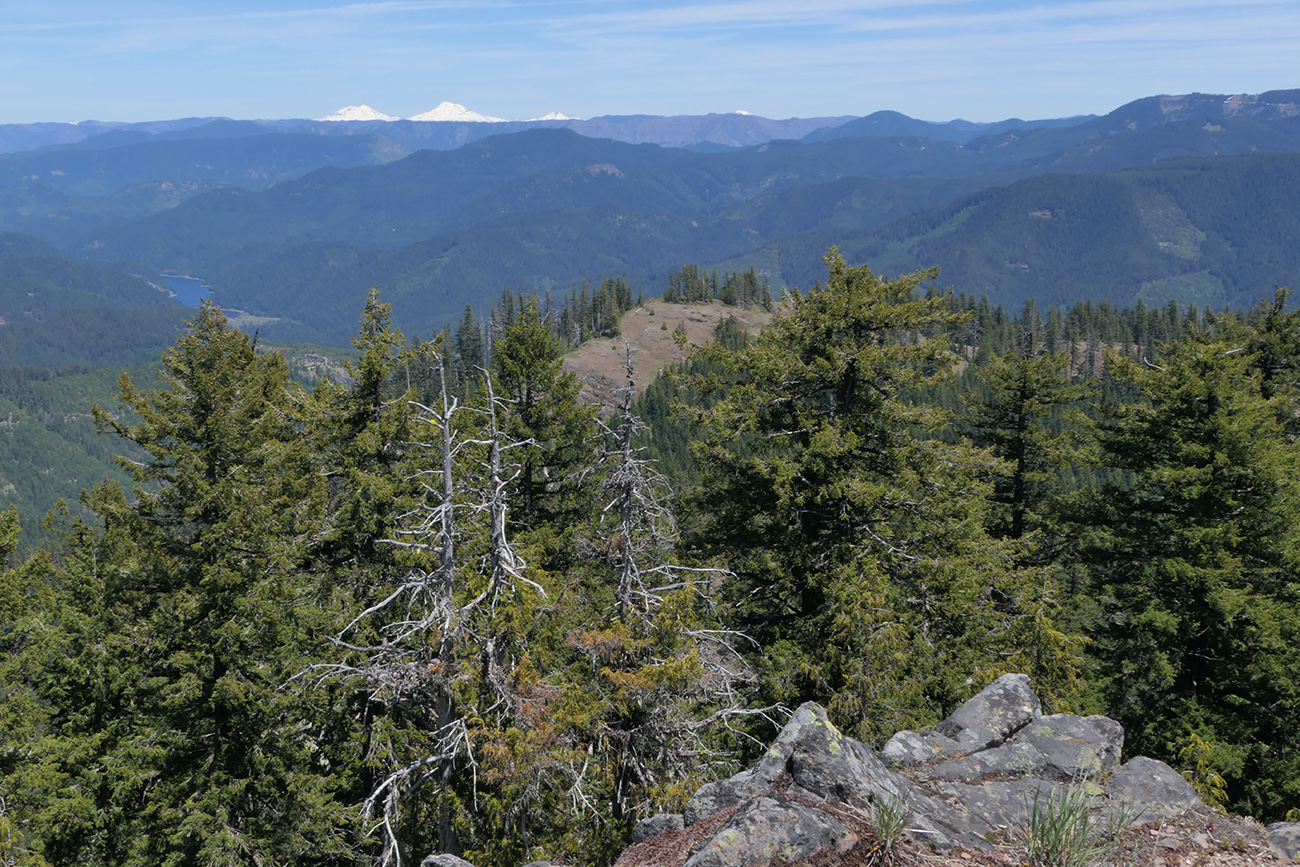
Looking to the northeast from the summit, you can see the snowy Three Sisters in the distance. You can also see the extensive damage of the 2022 Cedar Creek Fire, which burned from Waldo Lake all the way to west of Blair Lake. The nearby ridge I named Bearscat Ridge, but I haven’t been back up there since 2007.
Thinking About Climate Change at Youngs Rock

The north side of Youngs Rock is hard to get close to. Although there’s no talus, the slope is still quite steep and slippery, and the rock outcrops are not all stable. It reminds me of a Japanese garden. With binoculars, I could see lots of blooming Oregon fawn-lilies and a single cliff paintbrush, but I didn’t feel comfortable trying to get close to them like I did when I first started coming here.

The south side of the rock is really craggy and supports many interesting plants in its cracks. It’s open but also really hard to get up close to because of the slippery and steep talus at its base. Better have binoculars!
On May 26, Lauren Meyer and I spent a beautiful day hiking up to Youngs Rock. It was sunny but only in the low 70s—pretty much perfect. In my work for the Flora of Oregon, I had just read through a draft copy of a chapter on climate change that will be part of the third and final volume of the flora. I couldn’t help but look at what we saw along the trail through the lens of climate change. We discussed it quite a bit as well. The Youngs Rock trail follows a south-facing ridge in the Rigdon area of southeastern Lane County. We hiked the middle stretch—my favorite part through a string of meadows—from about 3100′ to Youngs Rock itself, an impressive pillar rock, at about 4500′. There are a number of plants here that are near the most northerly edge of their range. These include whisker brush (Leptosiphon ciliatus), ground rose (Rosa spithamea), birdbeak (Cordylanthus sp., I’m still unsure how to distinguish the species), and many-stemmed sedge (Carex multicaulis). I’d only discovered the latter a couple of years ago (see Back to Lower Meadows of Youngs Rock) and was surprised at how much more there was along the lower stretches of the trail. I’ll admit I don’t spend much time on graminoids, and this sedge looks more like a rush (Juncus spp.) than a sedge. Farther up the trail, where we didn’t go on this trip, is the most northerly site (so far) for galium broomrape (Aphyllon epigalium). With the caveat that I’m not a scientist, I would think these meadows might adapt to climate change fairly well and could even become home to more species adapted to the hotter regions to the south, though I suspect blooming periods might move up. Read the rest of this entry »
Long-awaited Return to Mosaic Rock

The more-or-less east end of the rock above the road.

I spotted a small area of spring phacelia at Mosaic Rock. This is a new site for this easily overlooked species, which is only found in Douglas and southern Lane counties.
My husband isn’t excited about little plants the way I am, and waiting for me while I try to photograph butterflies isn’t his favorite way to spend the day either. So we don’t hike together all that often. But he does really like rocks, and I’d been wanting to take him to the amazing rock formation in the Rigdon area that Sabine and I named “Mosaic Rock” (43.4808°N, -122.4539°W) back in 2011 (see Amazing Rock Feature Worthy of a Name). It’s a magnificent example of columnar jointing, and the cracks provide a foothold for several special cliff-loving plants, including cliff penstemon (Penstemon rupicola) and Merriam’s alumroot (Heuchera merriamii). It’s several hundred feet high in places, about 1400′ long and less than 200′ wide, and reminds me of a giant that looks like a flying saucer or frisbee that crashed into the ground on its edge. While I had driven by it many times in the last decade since you pass under it on the way up to Bristow Prairie, I hadn’t explored the rock itself since that first trip. We finally made it there on May 20, on a perfect sunny but cool day. Read the rest of this entry »
Butterflying on Coal Creek Road

We couldn’t go up Coal Creek Road without checking out the amazing spreading dogbane (Apocynum androsaemifolium) patch just past the 4-way intersection at the top of the crest (43.3998°N, -122.4561°W). We delighted in the abundance of butterflies and the intoxicating fragrance of the flowers. While most of the visitors were checkerspots, we also saw some fritillaries, parnassians, coppers, and all three of our “ladies,” including this American lady.

Julia’s orangetips rarely sit still long enough to photograph them, so I was really pleased to capture this lovely male who was making the rounds of the tall bluebells (Mertensia paniculata) growing in the roadside ditches.
Coal Creek Road 2133 which leads up to the west end of the Calapooyas is one of my favorite places to do roadside botanizing and butterflying. It’s also one of John Koenig’s, so on July 13, we drove up there for an easy day as John was still recovering from some foot issues and wasn’t up to a real hike. It was warm, but there was still enough moisture in the many seeps and creeks along the road to nourish the flowers, which in turn attracted lots of butterflies. Here are some photographic highlights.

We scared up a family of grouse along the road. The cute babies all flew up into the trees.
Butterflying with an Expert at Bristow Prairie

Neil Bjorklund at the rock garden all geared up for a day of butterfly photography.

One of the odd cat’s ears (Calochortus sp.) I’ve seen so often at Bristow Prairie. Not only does it have two extra petals, it’s not clear which species it is.
It had been almost 20 years since I’d had the opportunity to go out in the field with butterfly expert Neil Bjorklund. Neil’s website Butterflies of Oregon is the resource for the butterflies of our state, and he was a co-founder of our local chapter of the North American Butterfly Association (NABA). On June 28, we headed up to Bristow Prairie, one of my all-time favorite spots. Neil had been to Bristow Prairie a number of times, but he hadn’t been to the small wetlands that—as far as we know at present—are the northernmost outposts of Sierra Nevada blues. He also wasn’t aware of the south-facing bald I call “the rock garden” or “Lewisia Point,” two other excellent places to see butterflies. Our trip was mutually beneficial—I showed him my favorite spots, and he taught me a lot more about identifying butterflies. Read the rest of this entry »
Another Butterfly Day at Spring Prairie

There’s quite a contrast between the Boisduval’s blue caterpillars almost motionlessly eating lupine pods and the frenetic activity of the ants running up and down stems and back and forth across the caterpillars. Most of the caterpillars we found were tended by these large red-and-black ants.
After the wonderful trip to the rock garden on the way to Spring Prairie in July (see Beautiful Spots on the Road to Spring Prairie), I was anxious to return to the area and check out the other spot I hadn’t been to in many years. Spring Meadow is a wetland in the drainage of Mule Creek between the rock garden and Spring Prairie. On August 3rd, Sheila Klest and I headed up Road 733. We saw lots of butterflies along the road, including quite a few at a patch of spreading dogbane (Apocynum androsaemifolium) I hadn’t known about. I definitely wanted to check it out but decided we should drive all the way to Spring Prairie first and work our way back slowly.

A few of the caterpillars had smaller ants. Although the caterpillars ranged from green to this paler pinkish color, they all had a reddish purple stripe down their back.
Gorgeous Day at Grizzly Peak

Siskiyou onion (Allium siskiyouense) was one of the standout wildflowers of the day. Its bright pink flowers lit up every rocky open area.

The variety of Camassia quamash here, var. breviflora, looked very different to me than what I have at home and usually see in the Cascades. Common camas I’m familiar with can be distinguished from great camas (C. leichtlinii) by its bilaterally symmetric flowers. But these were radially symmetric, and the inflorescences were tighter. They were in bloom in several seepy areas along the trail.
On June 30th, the second day of our short trip to the southern edge of the Western Cascades, my husband, Jim, and I headed slightly north to Grizzly Peak. We unplugged our car, now thankfully fully charged, and left Green Springs Inn after a very quiet and pleasant stay. We headed up to the east side of the Shale City Road loop and drove this narrow but paved road to the intersection of BLM Rd 38-2E-9.2, where there is a sign for the trailhead. I’ll admit that I was nervous until we saw the sign as I usually came up from Ashland where there are lots of signs pointing the way to the trailhead, and this way there wasn’t any road sign on Shale City Road at all. Thankfully we had a map and were pretty sure we were on the right road.
The day was perfect—clear and sunny but not at all hot. There were a number of cars in the parking area of this popular trail, but we only occasionally passed a small party of hikers, so it seemed much quieter than one might imagine. There were lots of flowers in bloom, including many that I rarely see. There were also a decent number of pollinators though not as many butterflies as I have seen on other trips. Here are some photos from the day.

Buckwheats were already in bloom, and this sulphur buckwheat (Eriogonum umbellatum) attracted a couple of cedar hairstreaks as well as several different beetles.

More of the same Peck’s phacelia (Phacelia peckii) that I’d seen the day before on Hobart Peak was in a number of open areas. It was a bit fresher and far more prevalent than I remember from past visits, probably from the above-normal moisture this spring. While looking at old lists, I noticed some confusion about whether the annual species here was Pringle’s (P. pringlei) or Peck’s phacelia. In a paper I found online (OregonFlora hasn’t completed the Phacelia treatment yet), the split in the key between the two similar species was that Peck’s has hairy filaments, which these did.

Eaton’s fleabane (Erigeron eatonii) is another species I rarely see. On Grizzly Peak, it seems to occur only in open areas in the large meadow in the center of the loop section of the trail. The Peck’s phacelia could be found alongside it there.

Bloomer’s fleabane (Erigeron bloomeri) is very cute with its button-like rayless flower heads. It grows in the rocky area just south of the loop trail. There’s now a pretty obvious path through the area that reconnects with the main trail.

This area was all new to Jim, so he spent quite a while enjoying the views. Happily, that gave me more time to photograph flowers! There is a good view of Mount Shasta from the off-trail area south of the main trail.

As we headed back, I was able to catch one quick photo of a large marble, a butterfly that only comes this far west near the California border. It was nectaring on bluedicks (now Dipterostemon capitatus).

The burned area at the south end of the trail is continuing to recover. It had been 8 years since I’d hiked this trail, so the young ponderosa pine and other conifers I had seen before were noticeably larger. Great polemonium (Polemonium carneum) was in full bloom in this area as well as just about everywhere along the trail.

There were more bees than I had seen anytime so far this year. Bumblebees were especially abundant, and seemed to be enjoying a wide variety of flowers. While I’m not sure of the bee species, clockwise from the upper left, the flowers are roundleaf alumroot (Heuchera cylindrica), Bloomer’s fleabane, Siskiyou onion, and candy flower (Claytonia sibirica). Note the pink pollen on the bee on the candy flower.
Monitoring Siskiyou Fritillary at Bearbones Mountain

Jenny taking notes about the Siskiyou fritillary population on the south ridge. The downslope gravel was awash with spring phacelia, Olympic onion, and Menzies’ larkspur.

The old growth forest is quite impressive along the trail. The trail itself is so little used as to be hard to follow if you haven’t been on it before. We had to cross over a number of large logs and small branches (I moved what I could to make the trail easier to follow), but it is worth it to see all the interesting species and beautiful flowers as well as the view from the top.
Middle Fork District botanist Jenny Moore had never been to Bearbones Mountain and had mentioned to me earlier in the year that she’d like to go check it out. After getting an e-mail last week from Chad Sageser that he’d cleared the roads (2127 & 5850) to Bearbones (thank you Chad!!), I suggested we head up there on Wednesday, June 15, the one day of the week that was supposed to have some sun. Luckily, both Jenny and Sheila Klest were able to make time to go out hiking that day. After all the rain we’ve had (yay!), and a trip to the Ochocos the week before, I was really looking forward to getting back to the Western Cascades. This was also my first trip to higher elevations (Bearbones tops out at 4910′).
After missing the trailhead last year (see Return to Bearbones Mountain), I made sure to have the map on my phone ready. Chad had warned me that Road 5850, which leads to the trailhead, had been prepped as a firebreak when there were so many fires in the area last year. The edge of the road was logged, making it even harder to spot the trailhead, and forcing us to start our hike by climbing over a large pile of branches. The blooming dogwoods at the beginning of trail also helped me recognize the spot, and someone (Chad?) had left some red flagging across the road, but if you want to try the trail, having a map and GPS are a must, as there is no longer any trail sign. Jenny was interested in seeing the firebreak as one of the projects of the Forest Service is to figure out how to heal the roadsides after the disturbance and hopefully to replant with natives that are less flammable and lower growing. We all wondered why the downed trees and branches are left to dry out. It doesn’t seem to make any sense to create a firebreak and then leave all the flammable material in place. Maybe I’m missing something. Read the rest of this entry »